Boké
Boké is the capital city of Boké Prefecture within the Boké Region of Lower Guinea near the border with Guinea-Bissau. It is also a sub-prefecture of Guinea. Located along the Rio Nuñez which flows to its not-too-distant mouth on the Atlantic Ocean, Boké is a port. It is known for the Boké Museum, formerly a slave fort. The town is served by Boké Baralande Airport. As of 2014 the city and surrounding sub-prefecture had a population of 61,449 people.
According to the Encyclopædia Britannica, 11th edition:
"This part of the Guinea coast was made known by the Portuguese voyagers of the 15th century. In consequence, largely, of the dangers attending its navigation, it was not visited by the European traders of the 16th-18th centuries so frequently as other regions north and east, but in the Rio Pongo, at Matakong (a diminutive island near the mouth of the Forekaria), and elsewhere, slave traders established themselves, and ruins of the strongholds they built and defended with cannon, still exist (e.g., Fortin de Boké). When driven from other parts of Guinea the slavers made this difficult and little known coast one of their last resorts, and many barracoons were built in the late years of the 18th century. It was not until after the restoration of Goree to her at the close of the Napoleonic wars that France evinced any marked interest in the region. At that time the British, from their bases at the Gambia and Sierra Leone, were devoting considerable attention to these Rivières du Sud (i.e, south of Senegal) and also to the Futa Jallon. René Caillié, who started his journey to Timbuktu in 1827, did much to quicken French interest in the district, and from 1838 onward French naval officers, Bouèt-Willaumez and his successors, made detailed studies of the coast."
By 1849, the French had caused so much local resentment that France had to take over the Boké area. By 1895, it had become part of French West Africa.
Map - Boké
Map


Country - Guinea
 |
 |
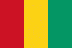
| Flag of Guinea | |
Formerly French Guinea, it achieved independence in 1958. It has a history of military coups d'état. After decades of authoritarian rule, in 2010 it held its first democratic election. As it continued to hold multi-party elections, the country continued to face ethnic conflicts, corruption, and abuses by military and police. In 2011, the United States government claimed that torture by security forces and abuse of women and children (including female genital mutilation) were ongoing human rights issues. In 2021, a military faction overthrew president Alpha Condé and suspended the constitution.
Currency / Language
| ISO | Currency | Symbol | Significant figures |
|---|---|---|---|
| GNF | Guinean franc | Fr | 0 |
| ISO | Language |
|---|---|
| FR | French language |